01
More time on each mission
Up to 59 minutes of flight time¹ means fewer returns for battery changes.
Note: Actual flight time varies with payload, wind and mission profile.

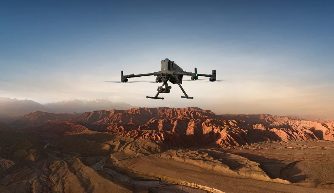
DJI ENTERPRISE / FLAGSHIP PLATFORM
Long endurance. Flexible payloads. Precise RTK positioning.
From infrastructure inspection to 3D mapping, build an aerial system around your mission.
SUNOVA INNOVATION × COLTEK ROBOTICS
59min¹
Max. flight time
6kg²
Max. payload
IP55
Ingress protection
20km³
Transmission range under CE
Figures are based on DJI’s specified test conditions. Not all configurations achieve these values simultaneously. See the conditions below.
01 / CAPABILITIES
Focus on what matters for your choice.
Technology that serves your daily work.
Up to 59 minutes of flight time¹ means fewer returns for battery changes.
Note: Actual flight time varies with payload, wind and mission profile.
Rotating LiDAR, millimetre-wave radar and vision systems work together to detect obstacles and support flight in complex environments.
Up to 6 kg payload capacity² supports a range of gimbals and additional equipment.
Note: Individual mounting positions have their own weight limits.
Supports RTK fixed-solution positioning and heading determination.
Note: Positioning accuracy is not the same as final survey accuracy, which also depends on the payload and workflow.
Video transmission up to 20 km³ under the CE standard supports your operations.
Note: Actual range is affected by obstacles and interference.
Automated routes and mission execution support data collection along predefined flight paths, reducing repetitive manual steps.
02 / APPLICATIONS & PAYLOADS
Matrice 400 is the flight platform; the payload determines what you capture. Select an application to explore a configuration direction. We will confirm the exact package with you.
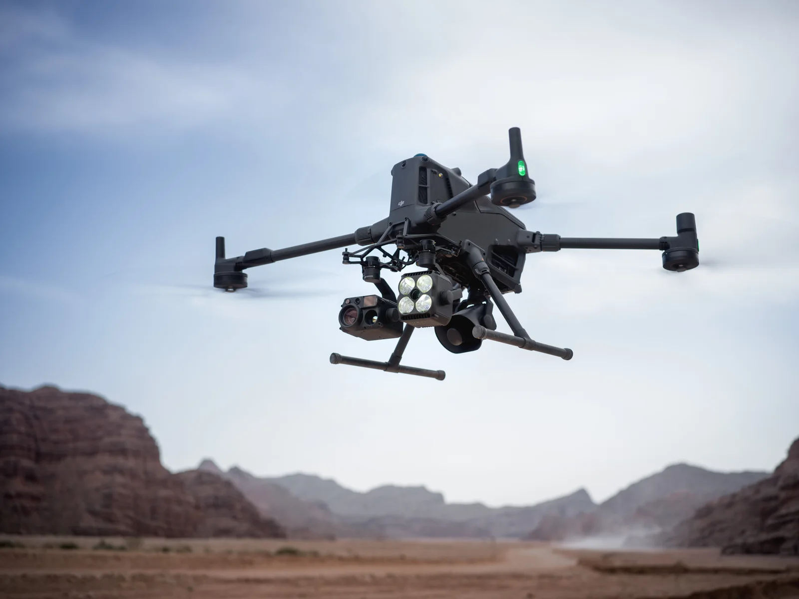 Illustrative setup · Not the selected package contents
Inspection & emergency response / Suggested setup
+ Zenmuse H30T
For infrastructure inspections, thermal anomaly checks and emergency scene assessment. Combine visual and thermal imaging to help your team understand conditions on site.
Intended outputs
Visual imagery · Thermal information
Ask about adding a Zenmuse S1 spotlight or V1 speaker if your mission requires lighting or voice announcements.
Enquire about this setup03 / SPECIFICATIONS
The figures that matter most when choosing a system. We can check the relevant conditions for your payload, environment and workflow.
Check suitability for my project| Max. flight time | 59 minutes¹At sea level, no wind, H30T only, constant forward speed of 10 m/s |
|---|---|
| Max. payload | 6 kg²Third gimbal connector; depends on mounting method and altitude |
| Max. takeoff weight | 15.8 kgTotal aircraft weight limit, not payload weight |
| Ingress protection | IP55Protection is not permanent and may decrease with wear |
| Operating temperature | −20°C to 50°CWithout solar radiation |
| Transmission range · CE | Up to 20 km³Unobstructed and free of interference |
| RTK fixed-solution accuracy | Horizontal: 1 cm + 1 ppmVertical: 1.5 cm + 1 ppm |
| Max. wind resistance | 12 m/sDuring takeoff and landing |
Dimensions exclude propellers. Unfolded dimensions include landing gear; folded dimensions include landing gear and gimbal.
¹ 59 minutes: measured at sea level in windless conditions with H30T only, flying forward at a constant 10 m/s until a forced landing due to depleted battery. Actual endurance varies with conditions, payload and firmware.
² 6 kg: applies to the third gimbal connector at sea level with screw fastening. The quick-release mount is limited to 3 kg. Payload capacity decreases at higher altitudes.
³ 20 km: communication range under the CE standard in unobstructed, interference-free conditions. This is not an operational radius or an authorised flight range.
Specifications and compatibility information refer to DJI official specifications. Payloads are selected separately. The confirmed quotation defines your configuration.
BEFORE YOU BUY
From the complete system cost to reusing existing equipment, get answers to the questions that shape your purchase.
Look beyond the aircraft price. Include the mission payload, spare batteries and charging equipment; mapping projects may also need processing software and an RTK service. Tell us your application, existing equipment and delivery country. We can propose a configuration and identify included items, options, taxes and shipping in the quotation so you can compare total costs.
Some payloads can be reused: DJI’s M400 compatibility list includes H30/H30T, L2 and P1. Payload compatibility does not mean batteries, controllers and mounting accessories are interchangeable. Send us your existing equipment models so we can check payloads, connectors and firmware requirements, then identify what to retain and what to add.
Do not plan a mission around the full 59 minutes. That figure was measured at sea level, without wind, carrying only H30T at a constant forward speed, until a forced landing due to depleted battery. Real missions need a return-to-home and safety reserve. Payload, hovering time, wind and altitude affect usable flight time. Share your payload and mission profile to assess whether the available endurance meets your needs.
Not necessarily. M400 can connect to a network RTK service through the controller’s Wi-Fi and is also compatible with D-RTK 2 and D-RTK 3 stations. The best option depends on internet and correction-service coverage at your site and whether you already own a station. Network RTK may incur service fees. RTK positioning accuracy is not the same as final survey accuracy.
04 / ENQUIRY & PURCHASE
Get an equipment list, quotation and delivery information for your project. Your selected application will be included in the enquiry.
Your configuration of interest
DJI Matrice 400
Inspection & emergency response · Zenmuse H30T
Change application & configurationSunova Innovation B.V. · Netherlands
Coltek Robotics GmbH · Germany
DJI Matrice 400
Configuration & quotation