
Lixel K2
Travel light. Bring the site back.
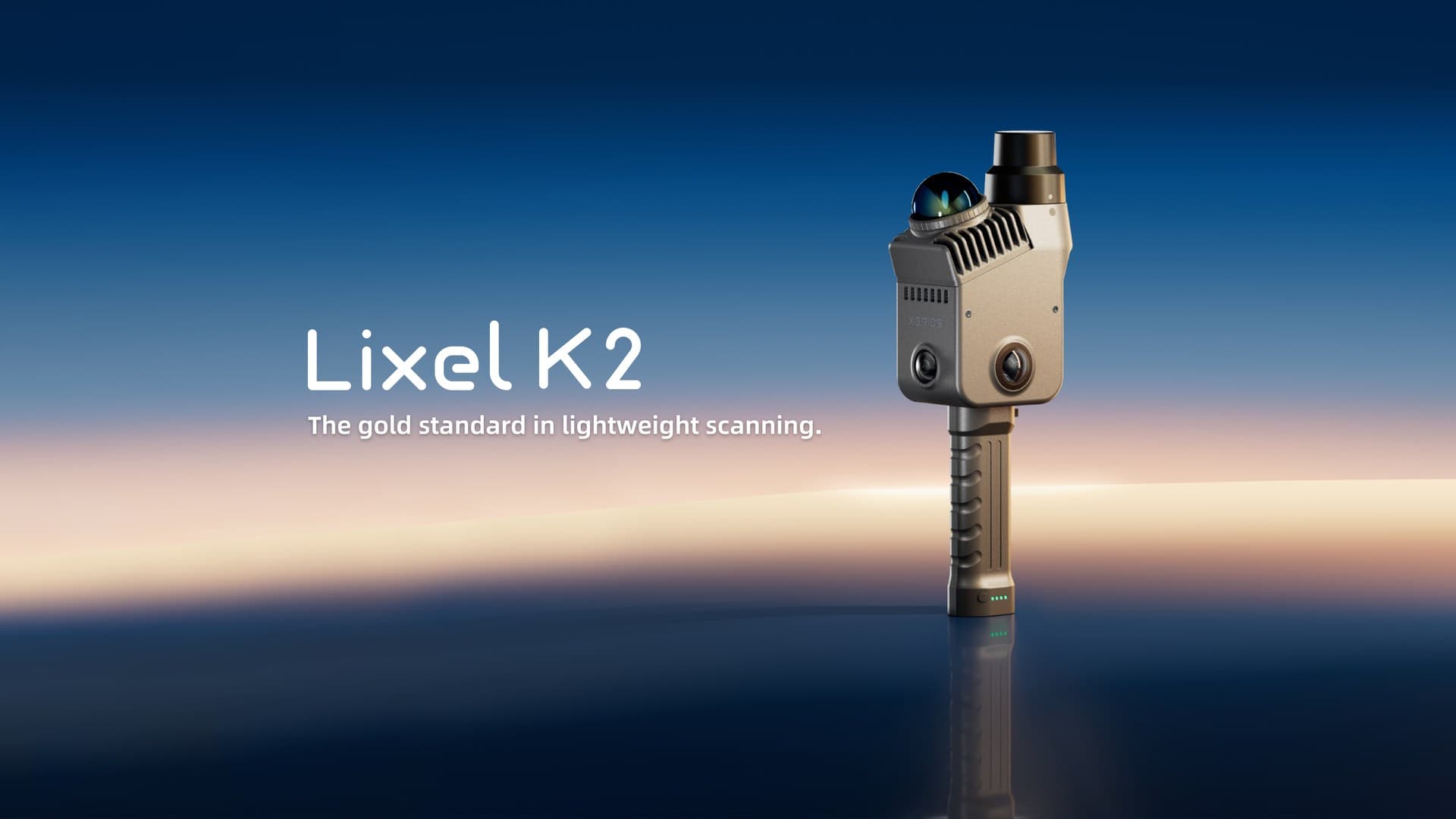
Approx. 1.2 kg with LiDAR, three cameras and RTK. From live point clouds on site to engineering data and reality models, choose a processing path for your deliverable.
Lightweight hardware. Close attention to detail.
Capture efficiency and data quality both matter. Check coverage first, then process the data for the required deliverable.
- Relative accuracy¹
- 1 cm RMSE
- Post-processed point cloud thickness
- ≤1 cm
- Weight (including battery and base)
- Approx. 1.2 kg
¹ Laboratory conditions, with point-to-point distances within 10 m. Actual results vary with the scene and operating conditions.
Structure and colour,
captured clearly.
Two fisheye cameras and one forward camera record colour detail. Multi-SLAM fuses spatial sensing, while built-in RTK supports coordinate positioning.
- Guided scanning and real-time quality checks
- Real-time dynamic object removal, filtering and colourisation
- In-app measurement and point cloud file sharing
One capture. Choose the output for your project.
Use the live point cloud for on-site checks. Keep the original capture data for engineering point clouds, textured meshes or 3DGS processing.
Check coverage before leaving the site.
Inspect the point cloud during scanning to identify gaps and assess capture quality. On-site preview is the starting point of the data workflow.
LixelGO · Field capture
Live quality checks, point cloud preview and in-app measurement
Mesh reconstruction requires the corresponding colourised data and panoramic photos. Functions depend on software version and licence; engineering point clouds and 3DGS use different PLY data structures.
From field capture to project delivery.
LixelGO checks field coverage; LixelStudio processes engineering data; LCC Studio reconstructs visual spatial content.
Spatial intelligence platform
Physical worldDigital world
Field capture
Lixel K2 + LixelGO
Capture while walking, check live point clouds and coverage, and fill gaps on site.
Keep the original capture data and process it for the required output.
Data processing

LixelStudio
Point cloud processing · Measurement analysis · Textured mesh

LCC Studio
3DGS reconstruction · Editing · Publishing
Data applications
Put data to work in real projects
Web
Web presentation
Unreal Engine
3D engine
Unity
Interactive development
Cesium
Geospatial
Autodesk
Engineering design
Vision Pro
Spatial experiences
Connect through suitable formats, plugins or SDKs
Technology behind the workflow
Multi-SLAM
Multi-sensor fusion
High-performance computing
Data processing
3D Gaussian Splatting
Real-world reconstruction
Spatial AI
Spatial understanding and computing
This diagram shows the XGRIDS platform ecosystem and technology architecture. Not every output imports directly into every platform; check formats, software versions, plugins and licences.
Each processing path needs the corresponding software and licence. Check formats, plugins and target platforms for your project; not every output imports directly into every application.
Watch the full introduction,
then decide if it fits.
Lixel K2 Official full introduction. Press play to enable sound, seek or watch full screen.
Specifications for your decision.
Full official specificationsScanning & accuracy
- Relative accuracy¹
- 1 cm RMSE
- Absolute accuracy²
- Horizontal / elevation: 3 cm RMSE each
- Real-time absolute accuracy²
- Horizontal / elevation: 3 cm RMSE each; WGS84 / CGCS2000
- Repeatability
- 2 cm (laboratory conditions)
- Post-processed point cloud thickness
- ≤1 cm
- LiDAR range
- ≥40 m at 10% reflectivity; maximum 100 m
- Point rate / LiDAR field of view
- 200,000 pts/s; 360° × −7°…+52°
- Laser class
- Class 1 · 905 nm
Vision & fieldwork
- Cameras
- 2 fisheye + 1 forward; 1/2″ CMOS
- Image resolution
- 4000 × 3000; rolling shutter
- Camera field of view
- Panoramic 200° × 200°; forward 100° × 85°
- Weight
- Approx. 1,200 g, including battery and base; excluding other accessories
- RTK
- Built-in module
- Battery / runtime
- Clip-on 1,900 mAh; approx. 1.5 hours
- Environment
- IP54;−20~50 °C
- Storage / data interface
- 512 GB eMMC;USB 3.1 Gen2
Outputs & accessories
- Point cloud
- LAS · RCP · E57 · PLY · ILAS
- Images / mesh
- JPG / OBJ · OSGB
- 3DGS / other
- LCC2 · LCC · PLY / 3D Tiles · USD
- Included
- Phone mount, control-point base
- Optional
- Extension pole and adapter kit
- Processing software
- LixelStudio / LCC Studio; confirm versions and licences in the quotation
Tell us what you need to deliver.
Point clouds, meshes or 3DGS? Tell us the operating environment, accuracy requirements and receiving software so we can help confirm the configuration.
Enquire aboutLixel K2¹ Relative accuracy is laboratory RMSE at point-to-point distances within 10 m. ² Absolute accuracy requires open sky, no multipath, good GNSS geometry and favourable atmospheric conditions; real-time coordinates support WGS84 / CGCS2000. Runtime and capture results vary with conditions.
04 / Enquire
Discuss the product and your project
Tell us about your site, area and deliverables. We will confirm equipment, software, accessories and a quotation.
XGRIDS
Lixel K2